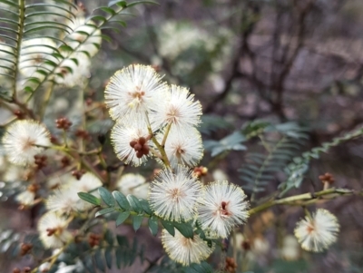
Wattles
Announcements
There are currently no announcements.
Discussion
abread111
wrote:
Yesterday
Not A. rubida - more than 1 nerve per face on the phyllodes. Can leave it to be whipper snipped again.
Acacia implexa
waltraud
wrote:
Yesterday
https://canberra.naturemapr.org/users/22862, apart from plantings by birds there were all kind of plantings by human/s in this area (they had protective guards) between the backyards and the Casuarina trail including non local she-oak, Cootamundra wattle and Red-stemmed wattle, A. rubida. I'm unable to id from your pic. Perhaps A. rubida?
Acacia implexa
BethanyDunne
wrote:
24 Feb 2026
Hi @MichaelMulvaney, interesting note on this population. It is all gone (dead) bar 2-3 plants in 1 location. Would be interesting to know if anyone has been monitoring them? Upcoming prescribed burn will be interesting to see if any seed has remained around the dead plants.
Acacia lanigera var. lanigera
TwoRivers
wrote:
23 Feb 2026
Look carefully at the shape of the leaf and the seed pod and aril.
Acacia buxifolia subsp. buxifolia
Significant sightings
- Acacia lanigera var. lanigera at Weetangera, ACT
- Acacia ruppii at Girraween, QLD
- Acacia baileyana at Springdale, NSW
- Acacia barringtonensis at Barrington Tops National Park
- Acacia awestoniana at Amelup, WA
- Acacia alpina at Yaouk, NSW
- Acacia alpina at Yaouk, NSW
- Acacia alpina at Mount Clear, ACT
- Acacia lanigera var. lanigera at Pearce, ACT
- Acacia brachybotrya
Top contributors
- Mike 715
- Darcy 465
- Tapirlord 459
- waltraud 310
- trevorpreston 285
- KylieWaldon 238
- abread111 225
- MichaelBedingfield 206
- JaneR 188
- ConBoekel 187
Top moderators
- Tapirlord 2K
- MichaelMulvaney 1.1K
- Darcy 499
- BettyDonWood 451
- natureguy 366
- MichaelBedingfield 329
- plants 280
- waltraud 168
- Mike 162
- RWPurdie 135


